

This post may contain affiliate links.
You can do a lot during one day in Shenandoah National Park, but you’ll need to plan your day wisely. When time is limited, I’d recommend checking out what the park has to offer by driving part of the 105 mile Skyline Drive, viewing some of the scenic overlooks, and then doing a couple short hikes representing the best of what the park has to offer: summits and waterfalls.
I visited and hiked Shenandoah National Park in June 2026. I found Doyles River Falls and Blackrock Summit two great hikes one day in Shenandoah National Park. Doyles River Falls is one of the parks waterfall hike highlights, and Blackrock Summit is a relatively short, but very scenic outlook hike, following a forested path out to rock cliffs and a vista view over the Blue Ridge Mountains. Blackrock Summit represents, in a compressed format, the forested terrain and vista overlook common to many of the summit hikes in Shenandoah.
Do Shenandoah as a single day or two half days
I did both of these hikes as separate half day adventures, since I also wanted to take in some site seeing around Charlottesville – checking out the University of Virginia, and Montecello, both Thomas Jefferson historical locations, well worth your time. But you could easily combine these hikes in a morning and afternoon in the park, with scenic stops along Skyline Drive, for a perfect one day in Shenandoah National Park.
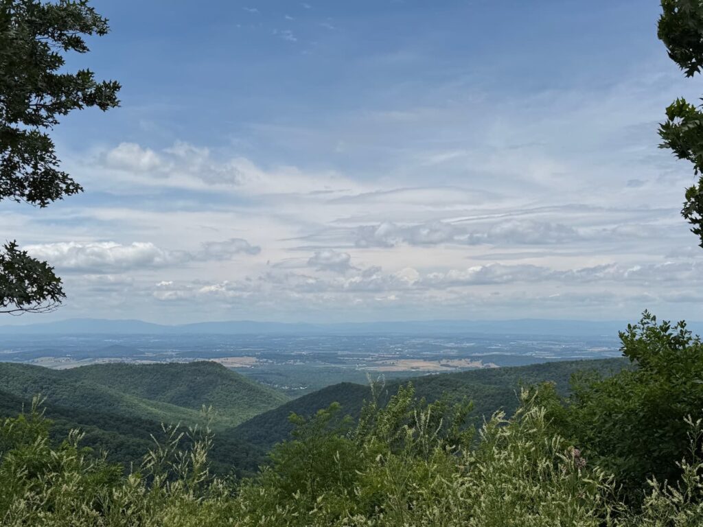
Let’s be clear, you could easily spend a week in the park, camping and exploring, and I’d encourage you to do so to be able to do longer hikes such as Old Rag Mountain, Bearfence Mountain, Hawksbill Mountain and Stony Man Mountain. But if you are combining a visit to the park with other sites in the Charlottesville area these two summit and waterfalls hikes will give you a nice introduction to the parks features and terrain, plus some good exercise to compliment a relaxing drive along Skyline Drive with view point stops.
History of Shenandoah National Park & what to expect
When Shenandoah National Park was created in 1935, it was envisioned as a place of refuge for nearby urban populations. The park features 300 square miles of the Blue Ridge Mountains, rising above the Virginia Piedmont to the east and the Shenandoah Valley to the west. There are two peaks rising above 4,000 feet, and more than 500 miles of trails in the park, leading to stunning waterfalls and spectacular mountain vistas. In addition to hiking, camping, fishing, wildlife viewing, and horseback riding are also popular activities. Skyline Drive, the parks scenic byway, has more than 75 overlooks with scenic views for miles.
Entrances to Shenandoah National Park
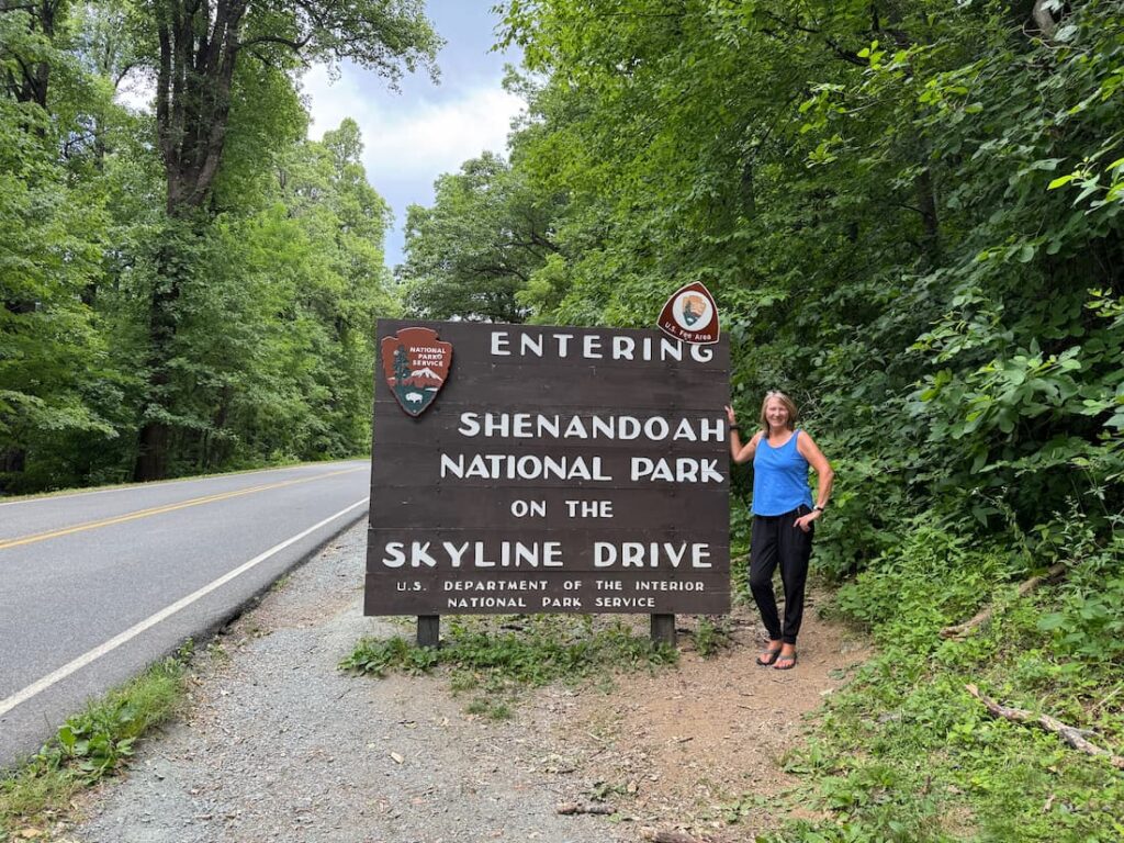
There are four main entrances to Shenandoah National Park: Front Royal (Mile 0.6) via US 340 and Highway 55, Thornton Gap (Mile 31.5) via US 211, Swift Run Gap (Mile 65.7) via US33, and Rockfish Gap (Mile 105) via I-64 and US 250. I used the most convenient from the Charlottesville area, the southern entrance at Rockfish Gap. Allow a 30-minute drive from Charlottesville to the park gate.
Plan your time cautiously
It pays to be ambitious in life, but less so in Shenandoah National Park. The park is very spread out over 105 miles along Skyline Drive. My best laid plans on paper for what I could accomplish in a day quickly went away once I realized the magnitude of the park. Prepare to go slow, and be modest in how much you can see and do. That’s why I suggest getting a feel for the park and overlooks while driving only a southern portion of it, and then hiking its two best features: summits and waterfalls.
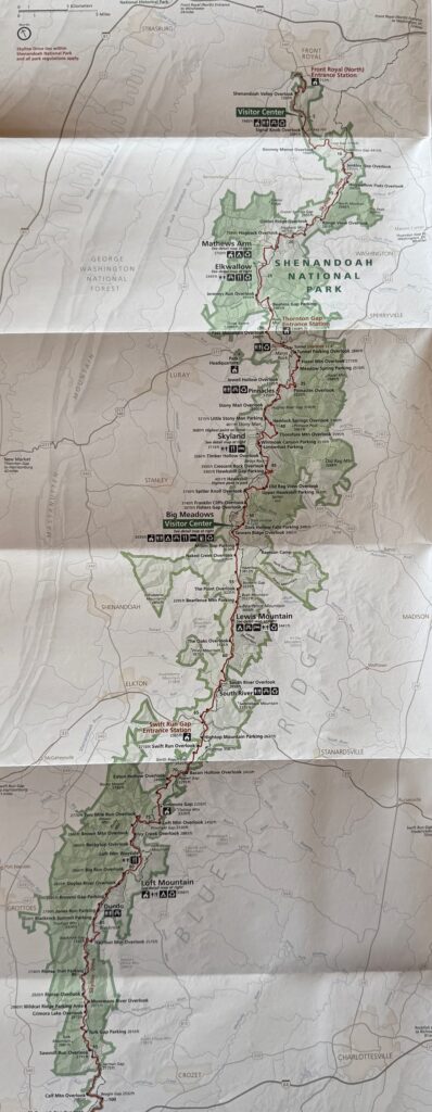
Driving times once you are in the park are remarkably slow, since Skyline Drive, which cuts north/south along the ridge of the park, features many tight turns, and is deceivingly long at the speed limit of 35 miles/hour. The 75 pull outs for scenic overlooks also add time, since you’ll want to have a look yourself, or allow others to enter or exit the main road. With distances and speed in mind, my first piece of advice for spending a single day in the park, would be to pick a region within 20 miles of your gate entrance to explore.
My planning fail
I had originally planned to hike my namesake “Mary’s Rock” at mile marker 45, but settled for a less ambitious plan centered around miles 80-85, once I realized I would need more than an hour to get further into the park, then allow for hiking time and the return drive.
Apparently underestimating distances is common. When I spoke to a park ranger, he said, “Most people entering the park for the first time misjudge the time needed for getting to hiking access points, or driving all of Skyline Drive.” I found focusing on a region closer to the south entrance, while still allowing significant touring along Skyline Drive once entering the park at mile 105 at Rockfish Gap, to be a good approach.
Mile markers along Skyline Drive
Mile markers run from 0 to 105, from north to south along Skyline Drive. A tip for first timers: the mile markers are cement posts, about three feet high on the right side of the road, when driving south from the northern entrance. That means if you’re entering from the south, they will be on your left, but the writing will only be visible from the other direction – or in your rear view mirror driving north! Let’s just say it took me close to the first 20 miles to figure that out, as I tried to reconcile the map mile markers with my plan on the ground. Consider this the rookie mistake I have saved you from!
Loft Mountain Area
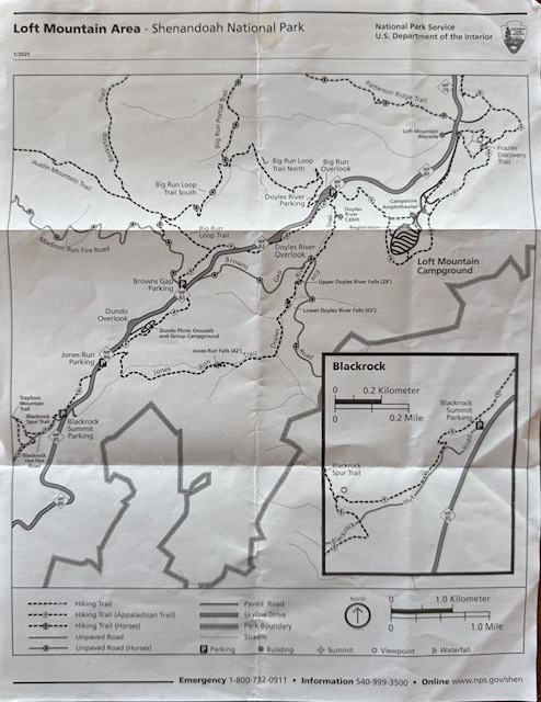
The Loft Mountain Area covers mile marker 80 to 86, and this is the area I would suggest you focus on if accessing the park from Rockfish Gap, the southern entrance, with the intention of spending one day in Shenandoah National Park. You’ll find both Blackrock Summit trail, and Doyles River Falls hike in the Loft Mountain area, as well as Loft Mountain Campground and numerous other hiking trails.
Blackrock Summit
At mile 84.8, Blackrock Summit offers outstanding views over the Blue Ridge Mountains, and outcroppings.
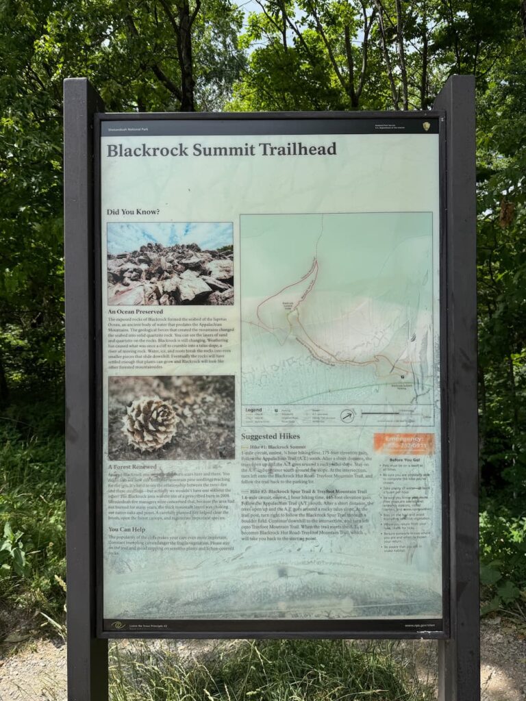
Blackrock Summit is also a relatively easy hike with a round trip distance of 1.0 mile. Guide books suggest allowing 1.25 hours, but if you are in reasonable shape, you’ll lap it in much less time. The trail is not all forested pathway as it first appears. There is a large pile of rocks by the overlook to navigate through, so be prepared for that at the end.
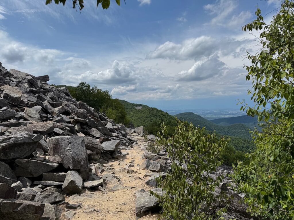
Be sure to take in the views of the Blue Ridge Mountains layered in the distance, before circling back. This trail, like many in the park, crosses portions of the Appalachian Trail, so be on the lookout for folks packing serious gear as multi-day or through hikers.
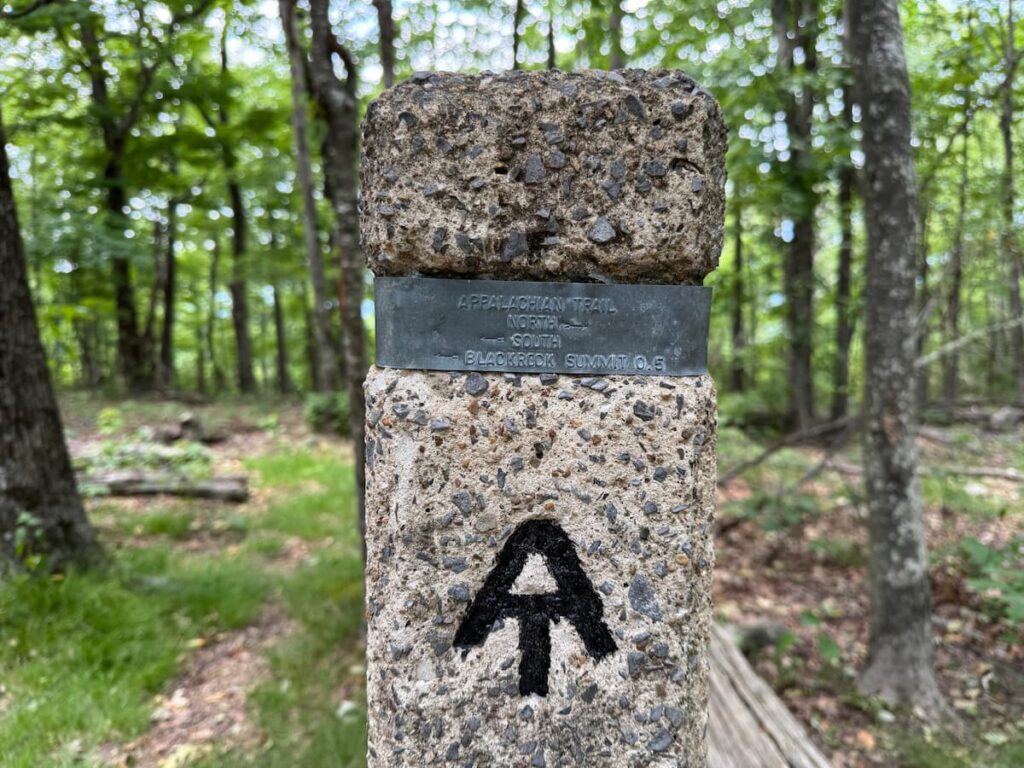
The trail is well signed with cement post markers sporting trail names on metal plaques. If you’re in need of additional exercise, or just curious to say you walked some of the Appalachian Trail, take a detour to extend your hike venturing along it, before circling back to the parking lot.
Blackrock Summit is one of the more popular trails in the park, and it’s easy to see why. This trail packs a lot into a short distance, is reasonably accessible, and has easy parking close by.
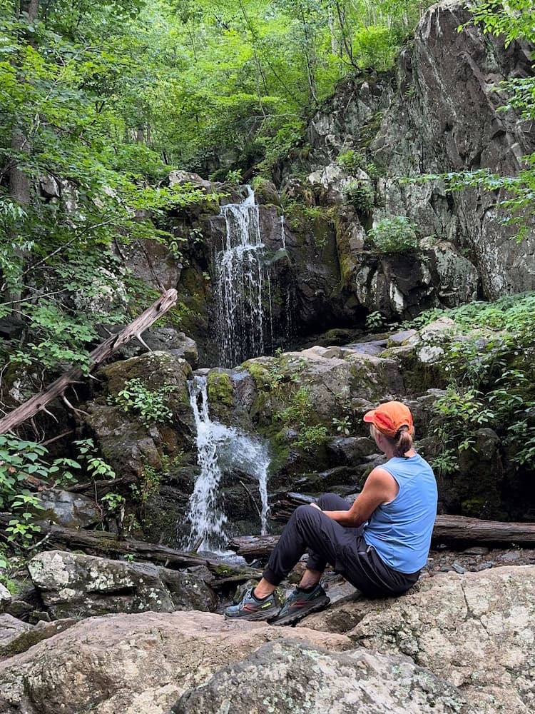
Doyles River Falls
Doyles River Falls is a 3.3 mile loop trail. You’ll find this hike more challenging than Blackrock Summit. Doyles River Falls has a 1,189 feet elevation change on both the decent to the falls and steady but relentless assent back to the parking lot. If you’re in good shape you’ll welcome the elevated heart rate and work out. If not, just go slow. The grade is gentle, shaded and easy to take breaks when needed. The pull off parking area is at mile 81.1 and is not far from Blackrock Summit.
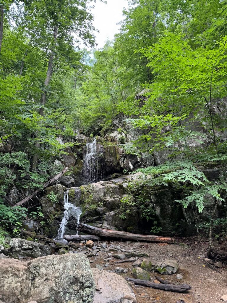
Doyles River upper and lower falls
There is an Upper Doyles River Falls, which is 28’ and Lower Doyles River Falls which is 63’. I would suggest hiking to see them both. They are reasonably close together, and heck, you’re down there already, why not? Both falls are best during the spring, or after a decent rain fall, so keep that in mind. The afternoon I hiked Doyles River Falls, the weather was humid and threatening showers, so overlooks had in and out clouded visibility, and I knew the waterfalls would be active, given the thunderstorm and rain activity the previous evening.
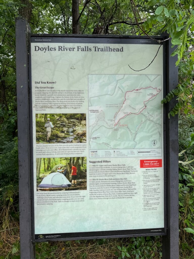
The guidebook suggests allowing 2.25 hours for this 3.3 mile hike. Being decently fit, I was able to hike it 1.5 hours return, roughly 45 minutes each way. I suspect the estimated time on the sign gives more time for the return since it is a steady uphill and switchback trek.
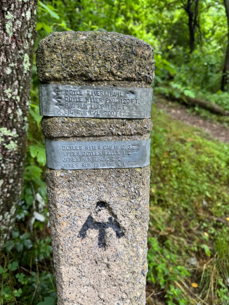
The waterfalls are quite lovely and refreshing. The hike up and down is mostly in the shade, well protected by the tree canopy of abundant deciduous trees. This trail also crosses part of the Appalachian Trail. I encountered several multi-day hikers along the way, and one fellow who had left Pennsylvania in mid-April.
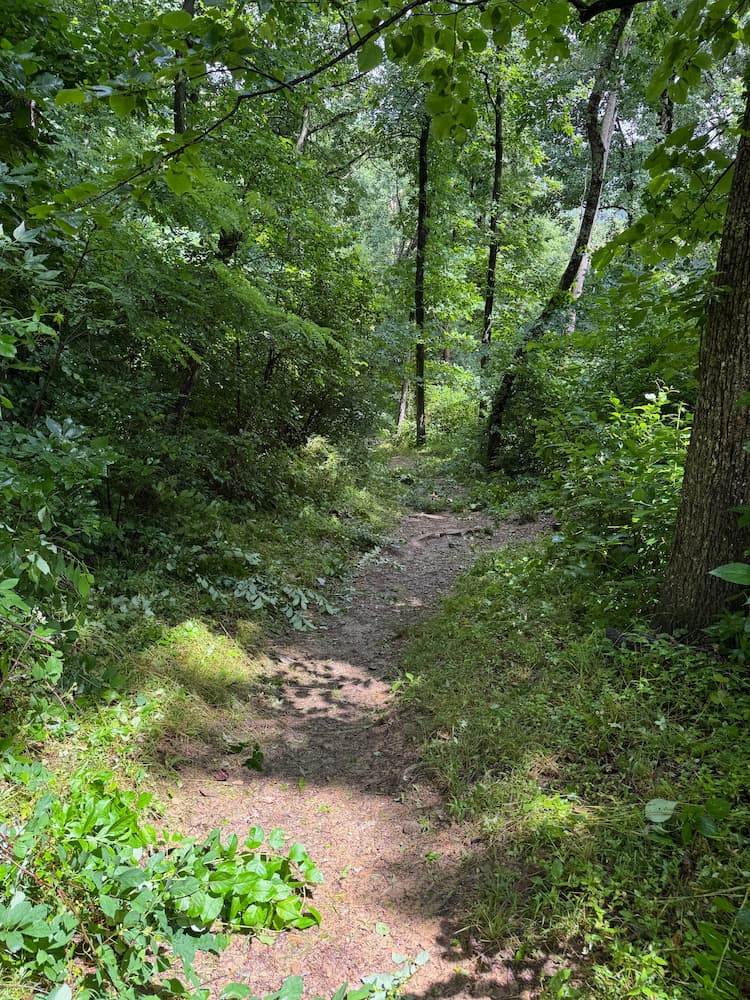
The trail also seems to attract fitness buffs training and running with weighted backpacks, no doubt using the valley 1,189 foot climb to build endurance.
Amenities
There is a campground in the Loft Mountain area, should you be planning an overnight stay. The Loft Mountain campground is the closest camping facility to the southern Rockfish Gap entrance.
Wayside gift shop and food service is also located in the Loft Mountain area, which is handy for a quick bite to eat, hydration or bathroom break. You can also pick up paper maps for trails in the area. There are also toilets at the Dundo picnic area just south of Loft Mountain, but no other services south, between Loft Mountain and Rockfish Gap entrance.
Maps & guides
Day hike and trail maps can be downloaded at www.nps.gov/shen and detailed maps and guides are available at www.snpbooks.org Trailforks or Alltrails apps are also useful in this area. Be mindful though, some areas of the park have limited or no cell coverage, so always be sure to have a paper map, or electronic map that functions without data.
Stay safe & be prepared
Mountain weather can change quickly. I experienced this even in June, due to thunderstorm activity in the area one day. Humidity and afternoon rain that clear the air is common during summer in Virginia, so keep that in mind. While weather can be clear and sunny in Charlottesville, you could still encounter showers, fog or clouds blowing in or out on the mountain.
Be sure to bring water, since the ability to refill bottles is limited, and plan hiking times to reflect daylight hours for your return – both hike and drive. While you can certainly drive in the park after sunset, it is a wildlife rich area. I saw numerous deer at road side in the afternoon.
Crank up the John Denver tunes for your Skyline Drive
The Shenandoah Mountains have shown up in the lyrics of many songs, but likely the best known is John Denver’s “Take me home, country roads” which includes reference to the “Blue Ridge Mountains and Shenandoah River.” Although I’m a city girl, I grew up in small town rural Canada, and I love country music – especially while driving in Virginia and Tennessee. So you’ve got to know I had John Denver cranked while driving along Skyline Drive. It’s a great way to put you in the mood for some summit and waterfalls hiking too!
Where to stay in Charlottesville
The Clifton
If you’re looking for a unique accommodation experience in the Charlottesville area, with oodles of history, and a higher end stay, may I suggest The Clifton, on its rolling estate just outside town? https://www.the-clifton.com/ Built in 1799, and the original residence of William Randolf and his wife, Martha Jefferson, the eldest daughter of Thomas Jefferson, you will be charmed by the property and services. The 1799 restaurant and the estate dining experience is worth an evening even if you’re not staying at the inn.
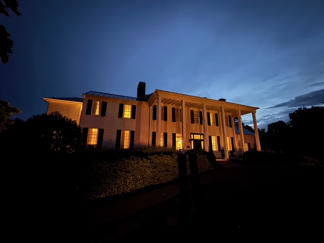
Link here to a more detailed review of my stay at The Clifton: https://carryonqueen.com/the-clifton-in-charlottesville/
Other sites to see in the Charlottesville area
If you’re going to tour two other places while in the Charlottesville area, make them Monticello and the University of Virginia.
Monticello
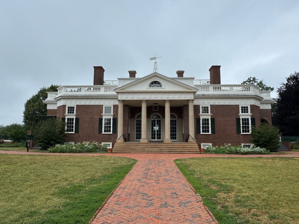
Monticello, Thomas Jefferson’s home and estate is a must see while in the Charlottesville area. Highlights tours are available daily, and include access to the property and several other additional tours such as Slavery at Monticello Tour, Garden and Grounds Tour, Meet Thomas Jefferson and Archaeology talks. When I was there in June I booked a 10:15 am tour and was able to spend three hours at Monticello before heading back to Shenandoah National park to do an afternoon hike.
Tours and times
Allow 45 minutes for the tour, plus additional time to shuttle up the hill from the visitor’s center. There are lots of self-guided interactive displays too, which you can spend considerable time checking out. https://www.monticello.org/visit/tickets-tours
Tours can be booked in advance, or purchased on site at the gate, but pre-purchase is recommended for ease of planning the balance of your day. The attraction does get busy and sold out, as evidenced by the packed parking lot the day I was departing.

There is a lot of US history wrapped in the Virginia area, and at the center of much of it is Thomas Jefferson, the author of the Declaration of Independence, State Governor, and the third President of the United States. Jefferson was a self-educated man who read and studied extensively about neo-classical architecture – his passion. This design influence was left on Monticello as well as the University of Virginia, which he founded in 1819. But Jefferson was also a complex man believing in both “freedom and equality for all” while also enslaving workers at Monticello, and profiting through their sale to the south. A tour of Monticello is highly recommended to further your understanding of American history and Jefferson’s influence on it. Link to the attraction here: https://www.monticello.org/
For a more detailed overview of what to expect at Monticello, along with my first had touring tips and history summary, check out the article I wrote about the experience: https://carryonqueen.com/is-monticello-worth-visiting/
If you are staying in Washington DC, group tours to Monticello, including transportation are available through GetYoutGuide. Check out tour options here.
University of Virginia
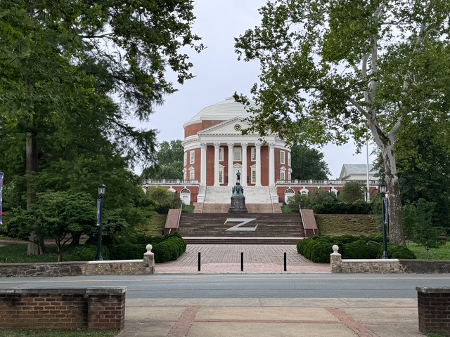
Even if it’s a whistle stop (which mine was!) on the way back from Monticello or Shenandoah National Park, be sure to check out the rotunda and library entrance building at the University of Virginia. It’s especially relevant in furthering your understanding of Thomas Jefferson’s imprint on the area and the European neo-classical architecture style he loved.
More US National Parks
Curious about hiking in other US National Parks? I’ve got you covered! Learn about 14 more hiking adventures through these additional articles published on this site.
Great Smoky Mountains National Park, Tennessee
Day hiking in Tennessee on the Appalachian Trail https://carryonqueen.com/day-hiking-in-tennessee-on-the-appalachian-trail/
Zion National Park, Utah
Is Angels Landing really that scary? (plus other hikes in Zion National Park) https://carryonqueen.com/is-angels-landing-really-that-scary/
Bryce Canyon National Park, Utah
Bryce Canyon in one day: hikes and sites not to miss https://carryonqueen.com/bryce-canyon-in-one-day-hikes-and-sites-not-to-miss/
Canyonlands National Park – Island in the Sky, Utah
Island in the Sky Canyonlands https://carryonqueen.com/island-in-the-sky-canyonlands/
Canyonlands National Park – Needles, Utah
Needles Canyonlands National Park: Day hikes and sites https://carryonqueen.com/needles-canyonlands-national-park-day-hikes-and-sites/
Capital Reef National Park, Utah
Capital Reef National Park: what to see and do https://carryonqueen.com/capital-reef-national-park-what-to-see-and-do/
Arches National Park, Utah
Arches National Park hikes: day visitor tips https://carryonqueen.com/arches-national-park-hikes-day-visitor-tips/
Grand Canyon National Park, Arizona
Route 66, the Grand Canyon and Zion National Park by motorbike https://carryonqueen.com/route-66-the-grand-canyon-and-zion-national-park-by-motorbike-what-a-ride/
Yellowstone National Park, Wyoming / Montana / Idaho
Yellowstone National Park + Beartooth Highway: Ultimate 2-day road trip https://carryonqueen.com/yellowstone-national-park-beartooth-highway-ultimate-2-day-road-trip/
Death Valley National Park, California
Death Valley in the spring: a two day guidehttps://carryonqueen.com/death-valley-in-the-spring-a-two-day-guide/
Joshua Tree National Park, California
Spring in Joshua Tree: a blooming good time to visit https://carryonqueen.com/spring-in-joshua-tree-a-blooming-good-time-to-visit/
Redwoods National Park, California
Damnation Creek Trail in Redwoods National Foresthttps://carryonqueen.com/damnation-creek-trail-in-redwood-national-park-mammoth-trees-to-the-coast/
Everglades National Park, Florida
Is Everglades National Park worth visiting? https://carryonqueen.com/is-everglades-national-park-worth-visiting/
Mauna Kea National Park, Hawaii
How to visit Mauna Kea at sunset: Hawaii’s Big Island 13,579fr sacred peak https://carryonqueen.com/how-to-visit-mauna-kea-at-sunset-hawaiis-big-island-13579ft-sacred-peak/
Shout out to photographer Taylor Wright for the Shenandoah National Park at sunrise photo used in this post!

Mary Charleson
Mary Charleson is an award winning travel writer and marketing/media strategist for 50+ adventure travellers. She publishes Carryonqueen.com and FiveMinuteMarketing.com. In 2025, Carryonqueen.com was awarded 2nd place for Best Self-Published Travel Website by Travel Media Association of Canada (TMAC). Mary also speaks to tourism leaders about marketing strategy and inspires audiences to explore.